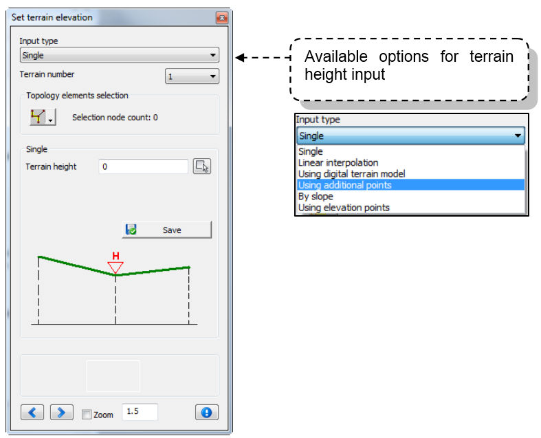
This command is used to input terrain elevation of the system elements. You can enter terrain elevations using several
options: single, using method of linear interpolation, using additional points, using DTM, using slopes or elevation points.
In Urbano it is possible to assign terrain heights up to 10 terrains – existing terrain elevations, designed terrain elevations for
solution 1, 2, 3... Because of that it is very important to select terrain number that the heights will belong to.
Terrain number refers to the Longitudinal section as well – it is very important which terrain is referent.

Methods
Single You can input terrain height for one single node. Select the node, enter the height or pick the text
from the drawing. Afet that click “Save data”. If you select more nodes (branch, array,…), use arrows at the bottom of the dialog
to switch to the next node.
Linear Interpolation Select some topology group – array, branch, sections from node to node.. Set terrain height for the
first and the second node and click Save. The program will assign terrain heights to all other nodes between them.
DTM You can use DTM or 3DFace created by TerraForm, or DTM created by Civil3D. If Urbano was installed
on the plain AutoCAD, you can use only DTM or 3DFace created by TerraForm.
Additional Points You can use this option if there are additional points in the drawing. You can create additional points
using command Draw – Draw Additional points.
Terrain elevations in nodes will be calculated by the the linear interpolation method from the elevation
of additional points. If "Use existing node elevation" option is active, the nodes that already have terrain
elevations will keep their values, and new values will be calculated only for the nodes that previously didn’t
have terrain elevations.
If that option isn't active, all nodes will get new values.
By Slope It is possible to set terrain elevation only for the first node of the selection, and set the slope toward the ending
node to calculate all terrain elevations for the nodes between.
Elevation points It is possible to set terrain elevation according previously drawn elevation points
(command Draw – Draw elevation points), and you can do it interactively or using buffer zone.